HAVERSTRAW:
Details of the Great 1906 Landslide
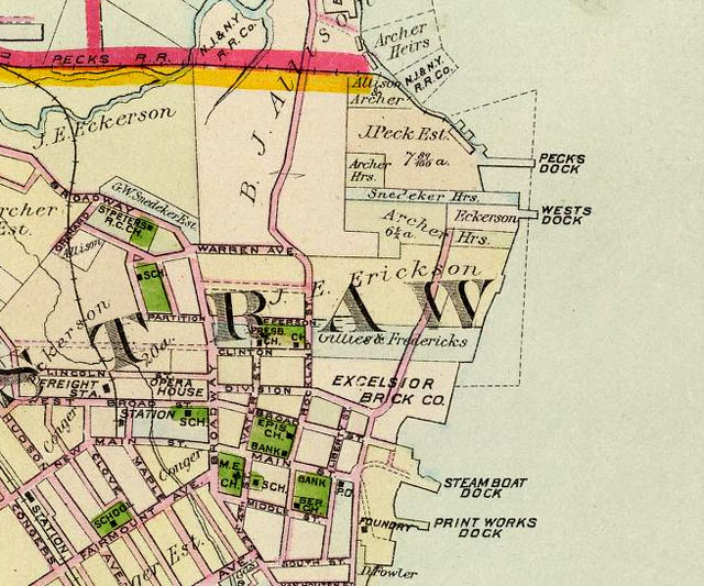
Map from F.W. Beers Rockland Cty Atlas, 1891
Compare the two images.
On the 1891 map, locate Jefferson St by the "R" in HAVERSTRAW. This is the northern terminus of where the landslide occured. Two blocks to the south is Division St. Looking at the recent satellite photo you can see how the landslide cut off Division at the Rockland Street intersection. And, on the 1891 map, you can see how Rockland used to connect with
Clinton, Jefferson and even Warren (partly visible at the top left of the satellite view).
According to the NY Times, the clay from the landslide landed in the yards owned by Eckerson and Gillies. You can see these names on the 1891 map, however exact land parcel locations may have changed by the time of the landslide, 1906.
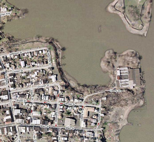
Recent Satellite View of Landslide Area (SOURCE: Google Maps)
BRICKYARD OWNERS & OPERATORS |
LANDSLIDE! |
HAVERSTRAW BRICKYARDS TODAY
BACK TO HAVERSTRAW HOME PAGE
|